Peaceline Wall
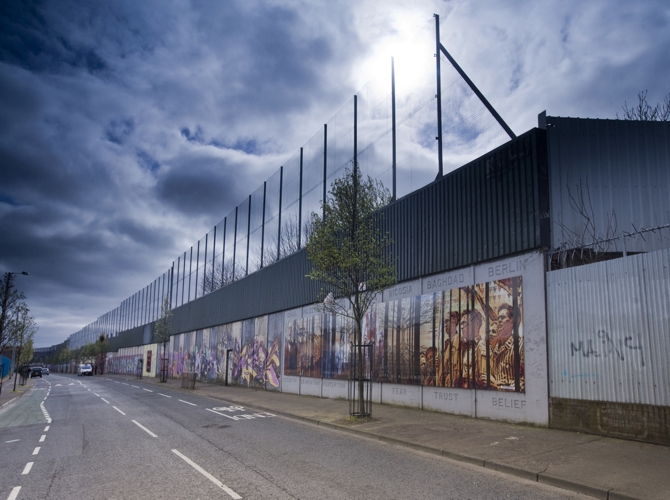
Some of the walls are high red brick structures with concrete trimmings. Some are metal fences.
The peacelines were intended to be temporary structures, erected to facilitate the policing of troubled areas and to keep Protestants and Catholics safe from attack.There are now estimated to be up to 30 miles of dividing walls throughout North and West Belfast.The peacelines of Belfast,while not architectural, are nonetheless dominant structural elements of the built environment and they remain as physical markers and reminders that the normalization in housing and civic space has some way to go.
The first peaceline was improvised from coiled barbed wire and corrugated fencing to split streets that linked the Falls Road to the Shankill Road in 1969. The army commander at the time scoffed at remarks that they would stand for years.
Photograph by Brian Morrison
Further Infomation
Location
The peace wall meanders through much of the west of the city, separating Protestant and Catholic areas. There are also many smaller walls in other parts of the city.
Address
Various locations across West Belfast
Belfast
Antrim
BT13
Geolocation
54.600757, -5.956505BUILDING INFORMATION
Year Opened
BUILDING TYPE
Concrete and steel high fence
BUILDING STYLE
Plain and functional; the peace walls have, over the years, become more solid and enduring in their appearance, having evolved from improvised structures. They are neat though hardly elegant.